After one week on the backpackers bus working our way up the east coast of the south island and across the ferry to the north island, I was ready for a break. Backpacker buses are a great way to see a lot of the country, but they can be exhausting as well. I needed a few days in one place where I didn’t have to unpack/repack within 12 hours.
Tongariro National Park seemed like the perfect opportunity between the two big north island cities, Wellington and Auckland. I hopped off the bus and booked three nights at The Park hostel/hotel. I arrived on Sunday and quickly settled in and found myself lounging in the hot tub and reading my book in the hammock. It was a great change of pace.
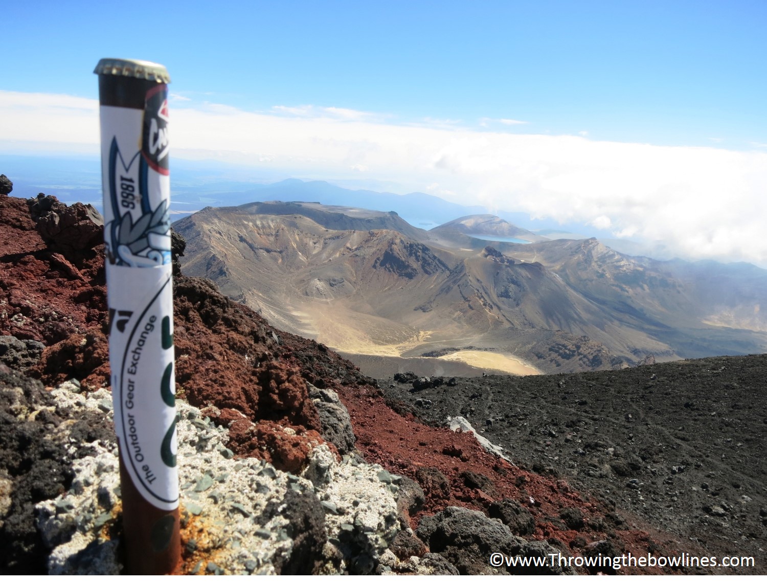
One of the main reasons I wanted to stop here was to do the infamous Tongariro Alpine Crossing hike. The image of the Emerald Lakes was one of the first I remember associating with New Zealand and these lakes were a part of the crossing.
The Crossing is 12.05 miles (19.4 km) and typically takes around 7-8 hours to complete. It consists of some steep climbs, but overall the elevation gain isn’t huge, just nearly 2520ft. (767 m). I was gearing myself up for it and was getting quite excited. The night before the hike, I met a group of backpackers that had attempted the crossing that day. Most had easily completed the crossing and had a really amazing time. Then I met a young Irish couple who had told me that in addition to doing the crossing, they also summited Mt. Ngauruhoe and Mt. Tongariro just shy of 8 hours!
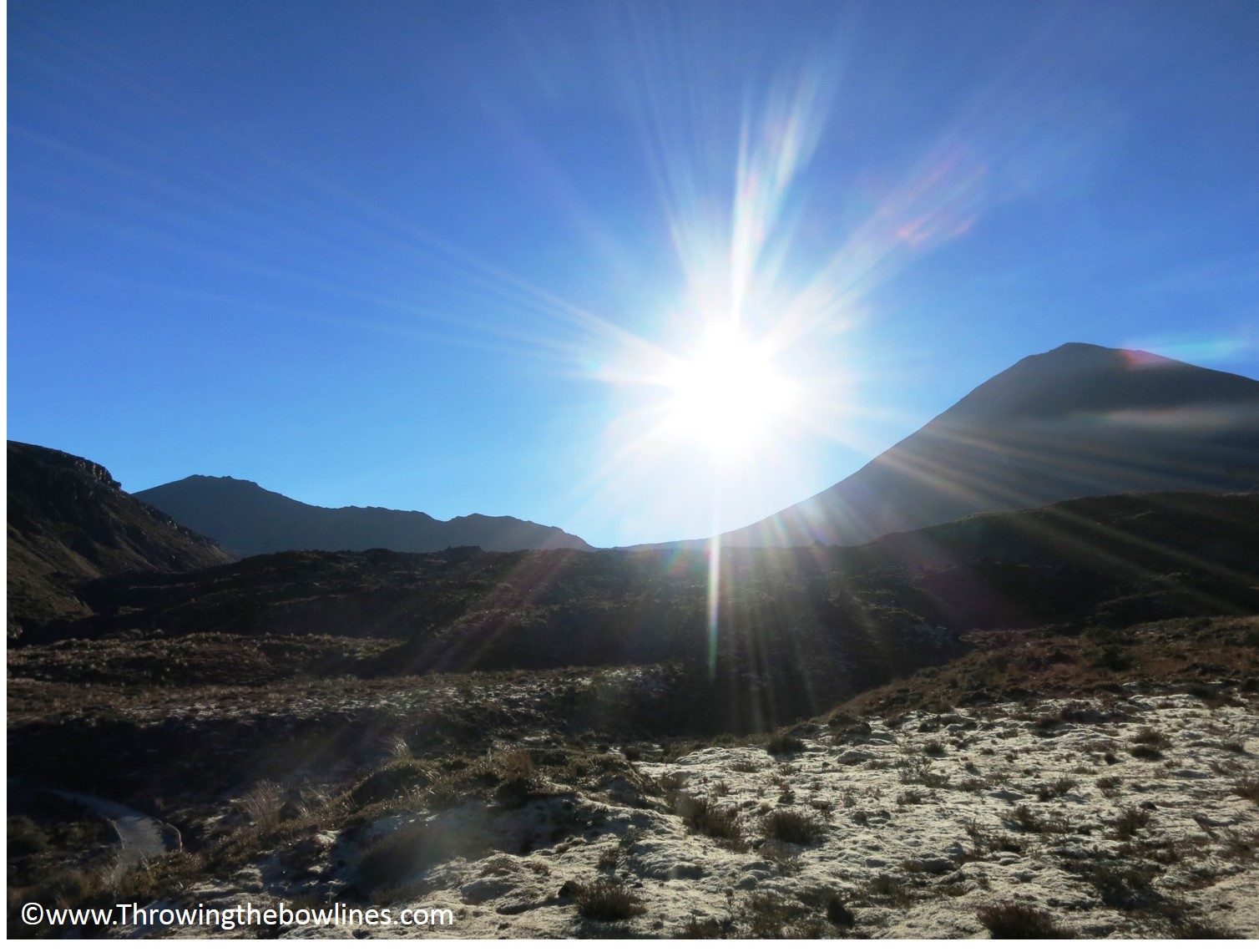
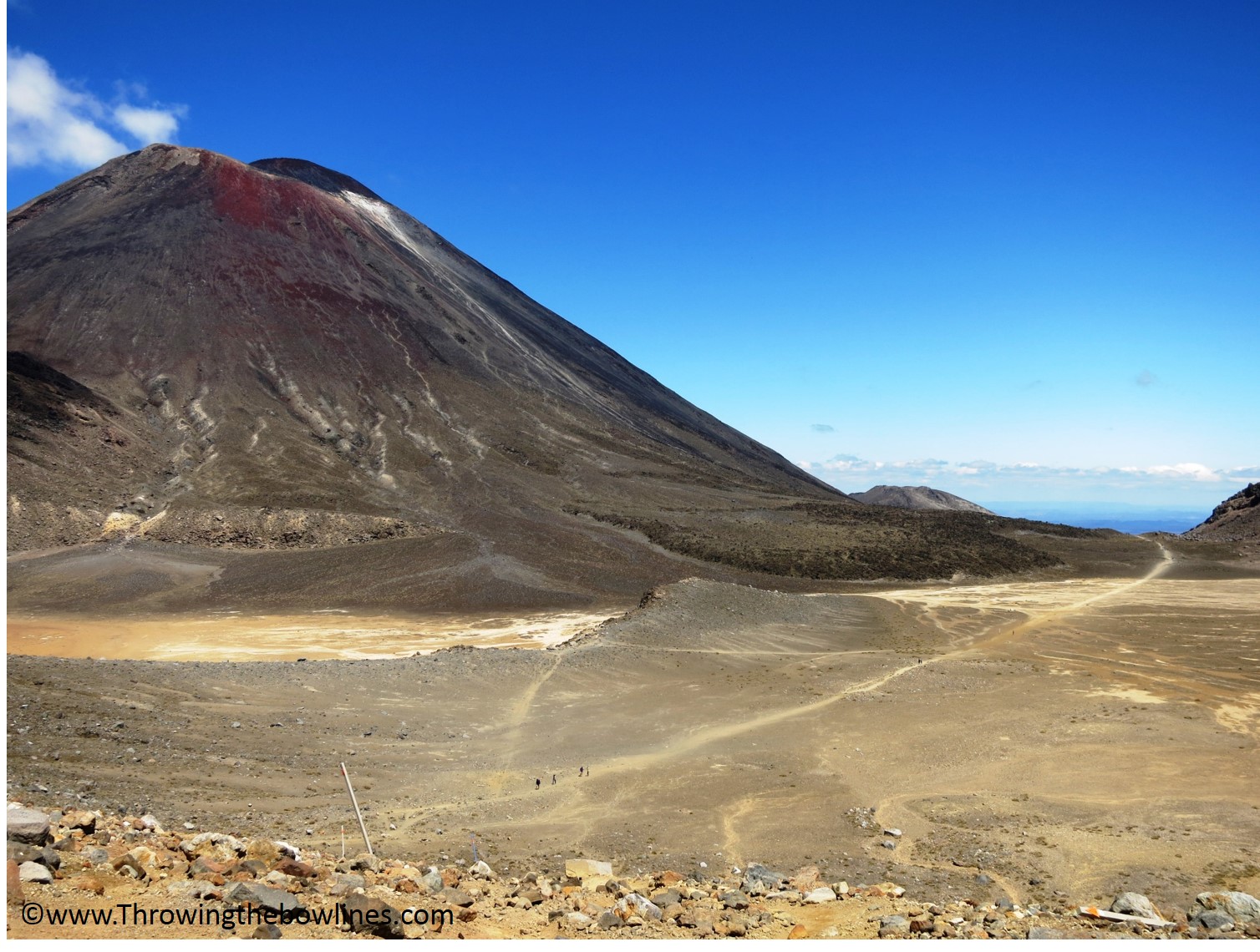
Mt. Doom on the right and Mt. Tongariro summit on the left.
Now, Mt. Ngauruhoe is also referred to as Mt. Doom thanks to its appearance in one of the Lord of the Rings movies (yeah, I realized I am probably one of the only people that has never seen LOTR). It is pretty massive mountain at 7,526 ft. (2,291m), but that wasn’t what intimidated me. I was told by others and the Irish couple confirmed that the climb was not your average mountain. It was covered in loose tephra, pilli, and ash which is leftover from volcanic eruptions. This means that as you take 2 steps forward, you are essentially sliding back down 1 step. Ugh. As they continued to talk about the summit and how amazing it was, I found myself really wanting to do it too! The biggest challenge is the allotted time that you have to complete everything. You have to arrange for transportation and most will give you 8 hours. After an hour long talk about it all, I was determined that I was going to go for the 2 summits in addition to the crossing!
The Attempt
The morning of the hike, our transport van left the hotel at 730am and dropped us at the Mangatepopo Car Park to start by 800. The hike is not roundtrip, therefore you have to arrange for pickup at the Ketetahi Car Park. Our driver advised us that there would be three pickup times, the first after 7.5 hours, then 8.5, and finally after 9.5 hours. After hearing this, I was so much more confident and determined to complete both summits knowing I had up to 9.5 hours. I anticipated it would take me around 8.5 and that was my goal.
The Irish couple let me know that I would need to move quickly, especially over the first 5km which was relatively flat and then try and maintain that pace as it got steeper. My goal was to make it to the Mt. Doom turnoff within 1.5 hours…I got there in 1 hour and 28 minutes (it is estimated to take 2.5 hours). Bingo! I was then onto the biggest challenge, 2,132 ft (650m) elevation gain, with a slope between 30-45°, over 3.7 miles (6km) on nothing but loose rock, gravel, and volcanic ash. What the hell was I thinking!?
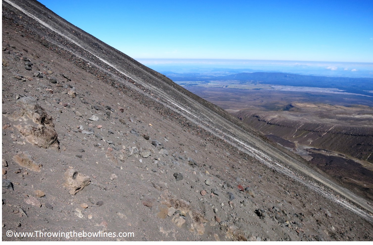
Just a bit steep, eh?
After 1 hour and 55 minutes, several falls, cuts, and stumbles, I made it to the summit!! It was a pretty amazing feeling and the views were like nothing I had ever seen! Mt. Doom is an active volcano, so you look down into a crater and are able to walk all the way around it (on a very small ledge), if you are feeling very adventurous (aka stupid). This was seriously the most difficult climb I have ever done. The steepness combined with the shitty rocks and ash make for one hell of a challenge!
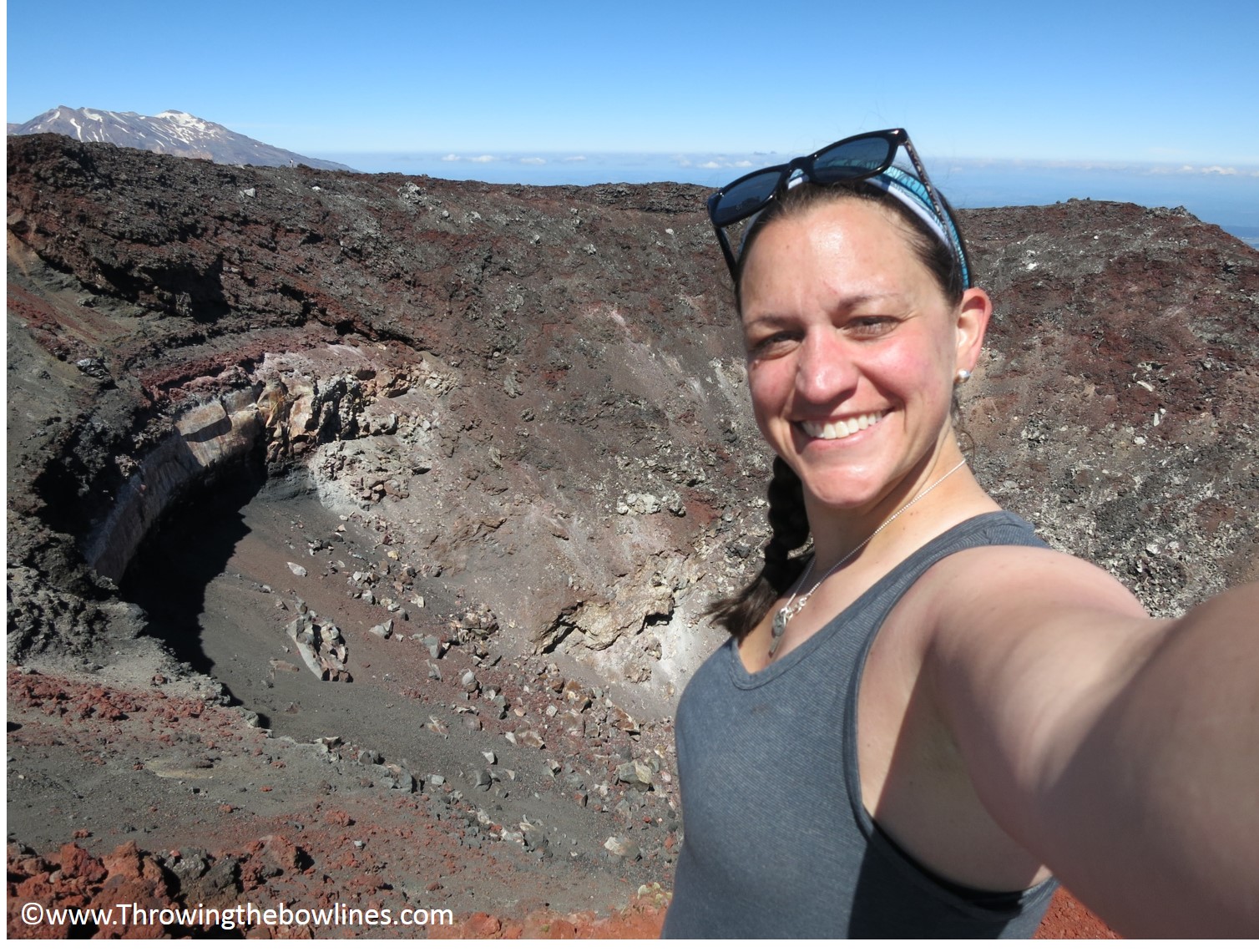
Success!!
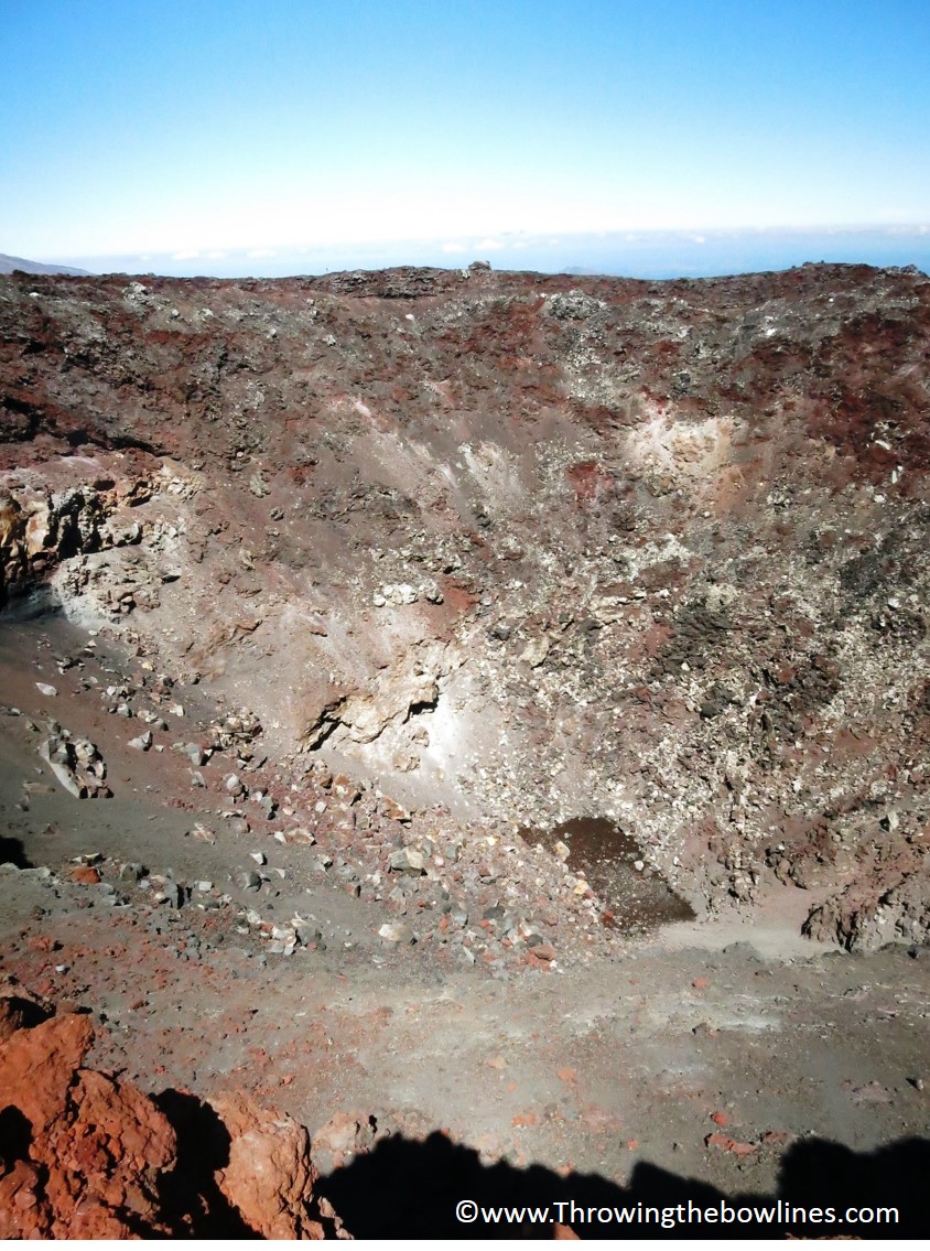
Looking into Mt. Ngauruhoe’s crater. It’s a long way down!
There way no marker at the top, so I improvised. Gorgeous views!
After inhaling my lunch and snapping a few photos, it was time to tackle the descent. Holy shit, this part was just as bad as the ascent, if not worse. Imagine trying to surf down rocks and sand while trying not to send a landslide down onto the person ahead of you and attempting to stay on your feet! Not easy at all! I fell onto to my ass so many times I thought I might not sit for a week! It took me 2 hours and 50 minutes to summit and descend the roundtrip route of Mt. Doom and I had to push onward!
A look back at Mt. Doom as I embarked on summit #2, Mt. Tongariro
Attempt #2: Mt. Tongariro
I was quite tired and sore after the Mt. Doom summit, but after another 40 minutes I came to the turnoff for Mt. Tongariro. I spoke with a guide who was trekking with a larger group and he told me that it was any easy summit and it shouldn’t take me any more than 1.5 hours roundtrip. I almost decided to skip it and just continue the crossing, but I knew I didn’t come all that way to give up on something I was set on doing. This summit was much less eventful than Mt. Doom, but gave rewarding views too as clouds were beginning to roll in. Within 1 hour, I had completed the 1.86 miles (3km) roundtrip summit and was very pleased that I pushed myself to do it!
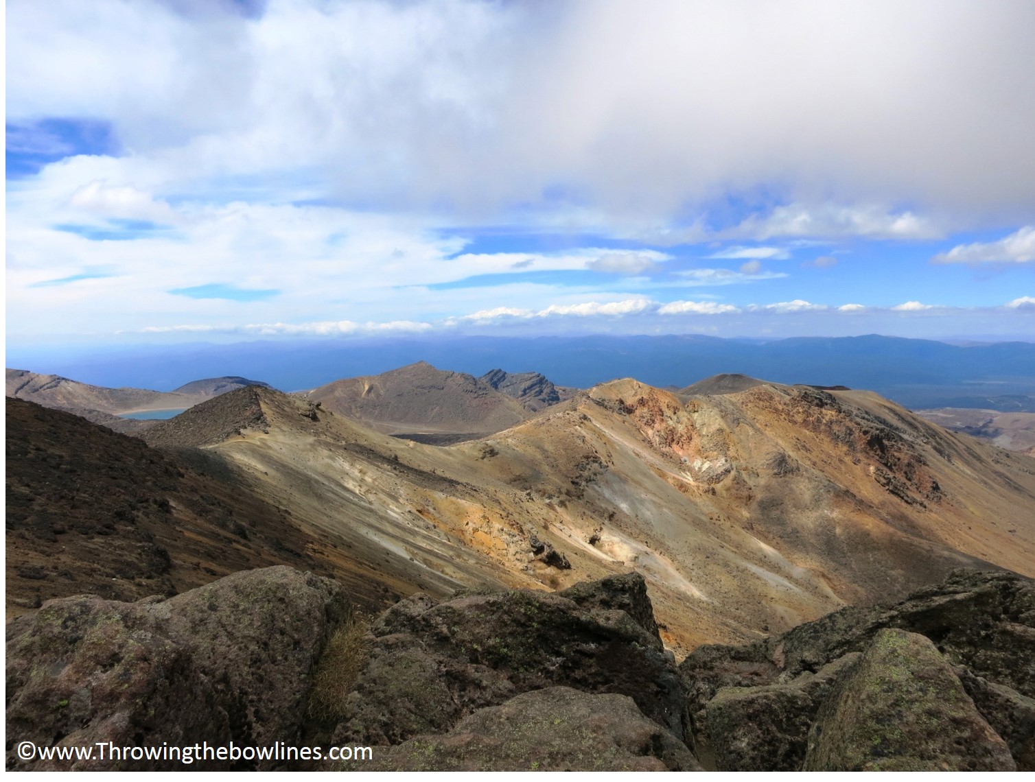
Not quite as impressive of a summit, but still amazing views!
The Finale
After I finished the summit of Mt. Tongariro, I had been hiking for just over 6 hours. There was still 7 miles (11.3km) to the end of the crossing and the trail was estimated to take 3 hours and 25 minutes. I had been beating the trail estimates quite easily, but as I grew more and more tired after then summits, I knew it would be hard to keep up my pace. But, in order to ensure I made the shuttle pickup, I had to keep moving.
I knew the Emerald Lakes were just over a small climb ahead of me and I used that as my motivation. I passed Red Crater on my way over the hill which was a gorgeous red. With clouds and wind rolling in, it looked like they made the crater look like this eerie deep red. Really quite awesome.
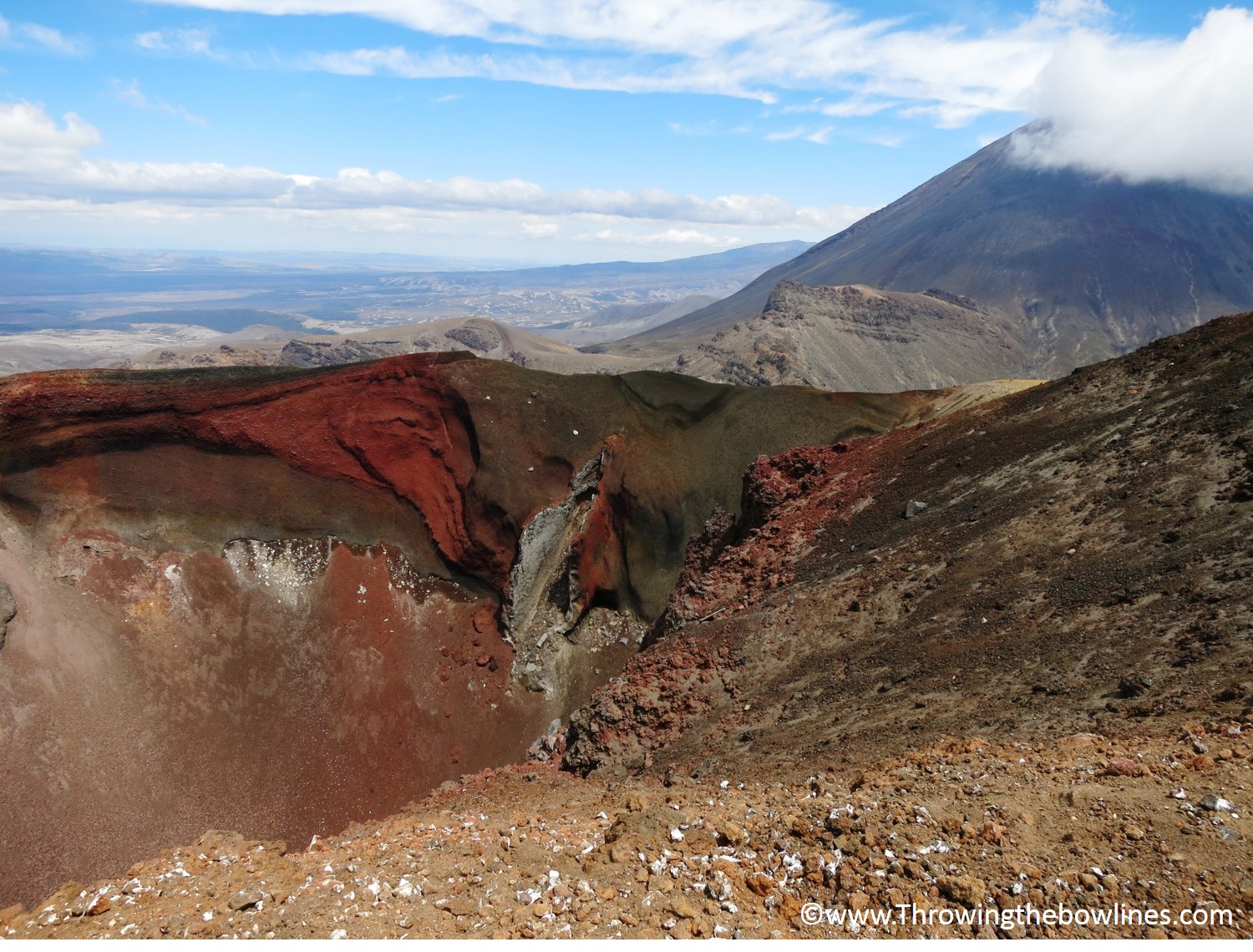
Red Crater with Mt. Doom
I was so excited to see the lakes and they did not disappoint. They were incredible and looked like they weren’t even real! I was truly in awe and they were as amazing as I had hoped they would be!
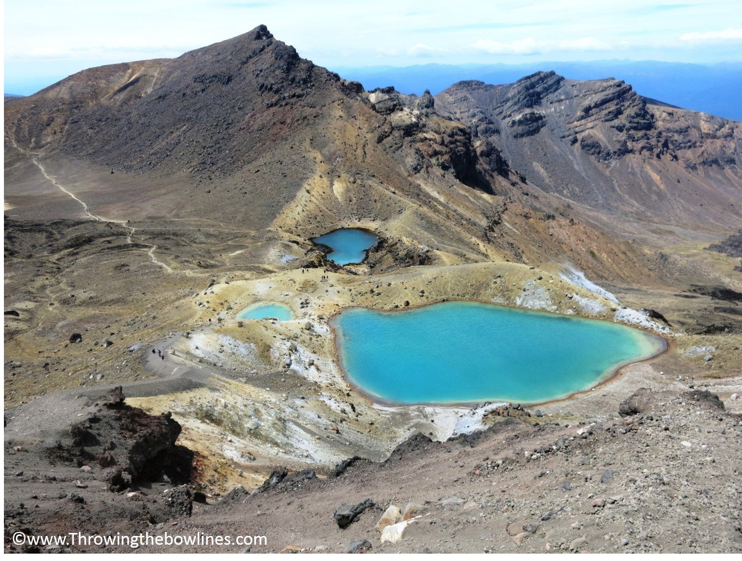
AMAZINGLY BEAUTIFUL!!
After the Emerald Lakes, it was time to find my fifth gear and get my ass to the finish! I am not sure how I did it, but I made it to the finish at the Ketetahi car park within 8 hours and 42 minutes! I was completely exhausted, sore, probably a bit dehydrated, a little sunburnt, but felt so proud of myself. I completed the challenge I set out to do!!
Final Stats:
Miles Hiked: 17.65 miles (28.4 km)
Time on the Trail: 8 hours 42 minutes
Elevation Gained: 4,978 ft. (1,517m)
Tips:
- Ensure you have plenty of food and water. I took 2.25 liters of water and budgeted it well over the course of the time, but would have loved to have more. Bring food that will give you plenty of energy and eat often so you don’t burn out.
- Wear sunscreen!! The sun is brutal on the mountain and you will need to reapply about 5-6 times over the course of your hike.
- Bring layers. The weather can change quickly and the winds can be quite chilly. Definitely bring a long sleeved shirt and rain coat.
- Know your limits. The summit of Mt. Doom is not a climb for beginners. Many people each year are rescued due to falling rocks and being stranded. Don’t become a statistic.
- Time your trek. If you plan to attempt the summits, start your watch when you begin so you can keep a close eye on time. Most transportation shuttles have one pick up time and if you miss it, it will cost you between $150 and $100 NZD for them to come pick you up again.
- Hire the right transport. Some shuttles offer just one pickup time (usually around 8 hours), but there are others that offer multiple. Ask around to find one that offers more than one, especially if you are planning to do any of the summits. This will give you extra time. I used my hostel, The Park, and at $30, I found it to be the best deal! You can always make friends on the trail too and ask them for a lift, if they have a car, if you get in a pinch!
Has anyone else ever done the Tongariro Alpine Crossing? Have you conquered Mt. Doom?
[…] Tongariro Alpine Crossing, New Zealand – February 2014 […]